Open this walk on the interactive map
Central Coast Bushwalk
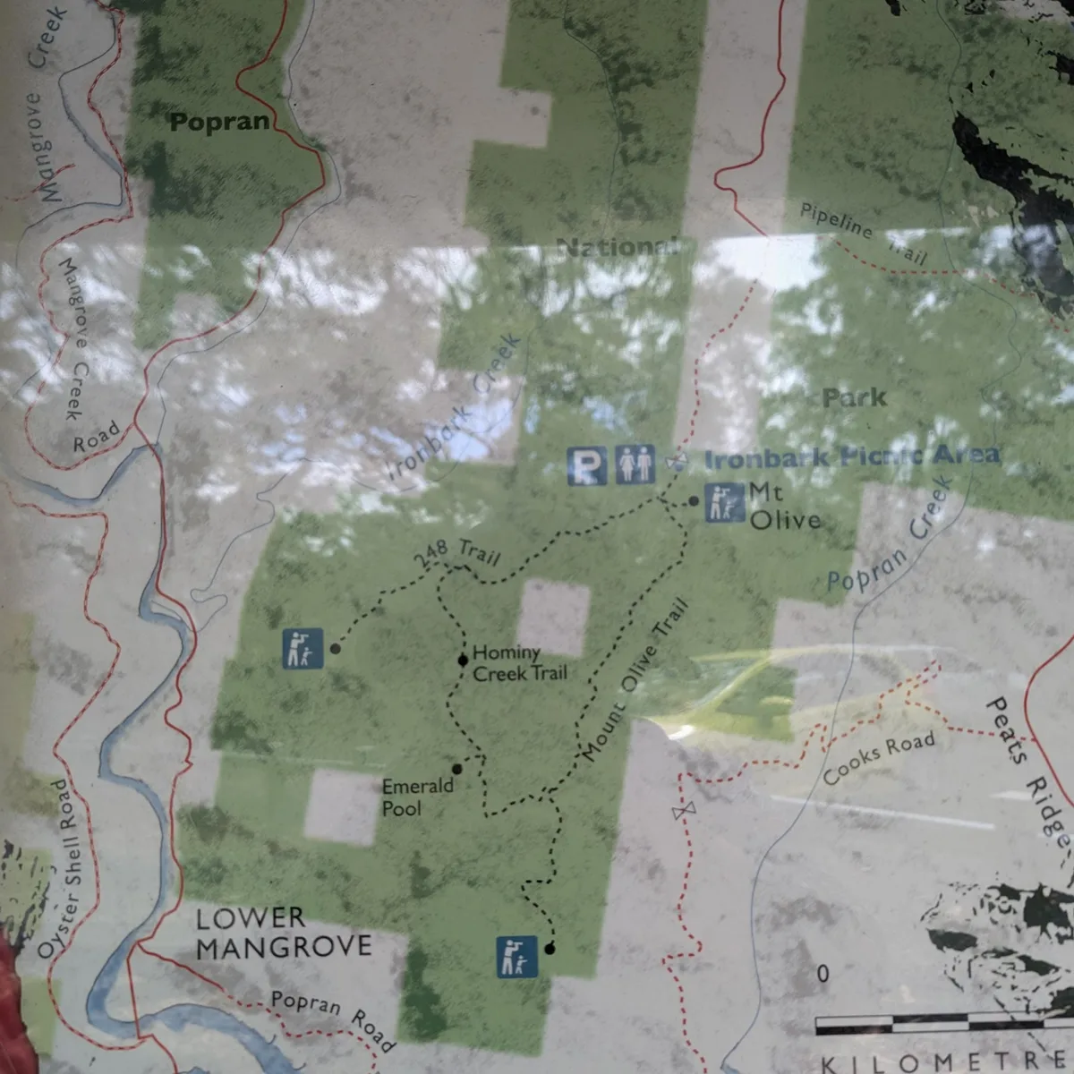
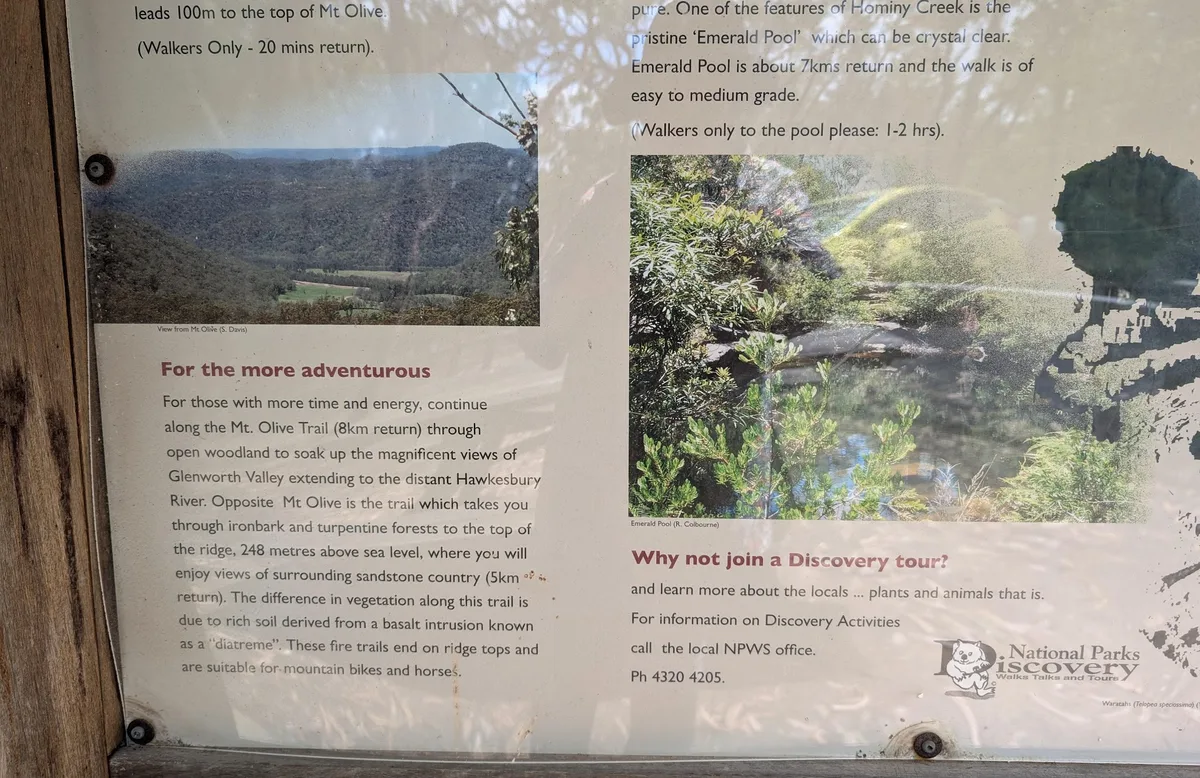
Popran - Mt Olive, Postmans Track and Emerald Pool (20km)
A 20km circular walk combining Popran, Mt Olive, and Postmans Track, finishing with a swim at Emerald Pool.
Elevation change: Up 50m, Down 50m
Walk directions
- Start at the end of Ironabrk Road: -33.375279, 151.193628 Google Maps Link
- Turn left: -33.386737, 151.186788 Google Maps Link
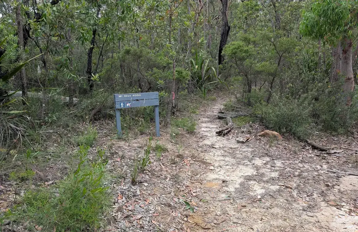
- Turn Left at the sign for Mt Olive: -33.386979, 151.186928 Google Maps Link
- Keep left and head up the hill: -33.387476, 151.188113 Google Maps Link
- Yay, you have reached Mt Olive! Head back down the hill and turn left, along the Mailman's walking track, this is a little track, not a fire trail, if you are at the fire trail you have gone too far. Head down the ridgeling, then down the hill: -33.387378, 151.189245 Google Maps Link
- Turn Right: -33.401423, 151.194084 Google Maps Link
- Turn Left right along Cooks Road: -33.402624, 151.193268 Google Maps Link
- Turn right up Popran Road: -33.412878, 151.188151 Google Maps Link
- Turn right straight awy up the walking track): -33.413147, 151.18784 Google Maps Link
- Turn right along the fire trail or turn left to head to the lookout and then come back: -33.411902, 151.178141 Google Maps Link
- Turn left: -33.403663, 151.178269 Google Maps Link
- Turn left the Emerald Pool: -33.402014, 151.172519 Google Maps Link
- Yay! You've reached the Emerald Pool, go for a swim and then head back, turn left at point 12: -33.402874, 151.171682 Google Maps Link


Get Started
Thinking about a
project?
Good Architect only takes a limited number of projects a year to keep the quality high.
Talk to Us